
Vikings of the Blue Ridge
Photos by Sean Rayford: October 10-12

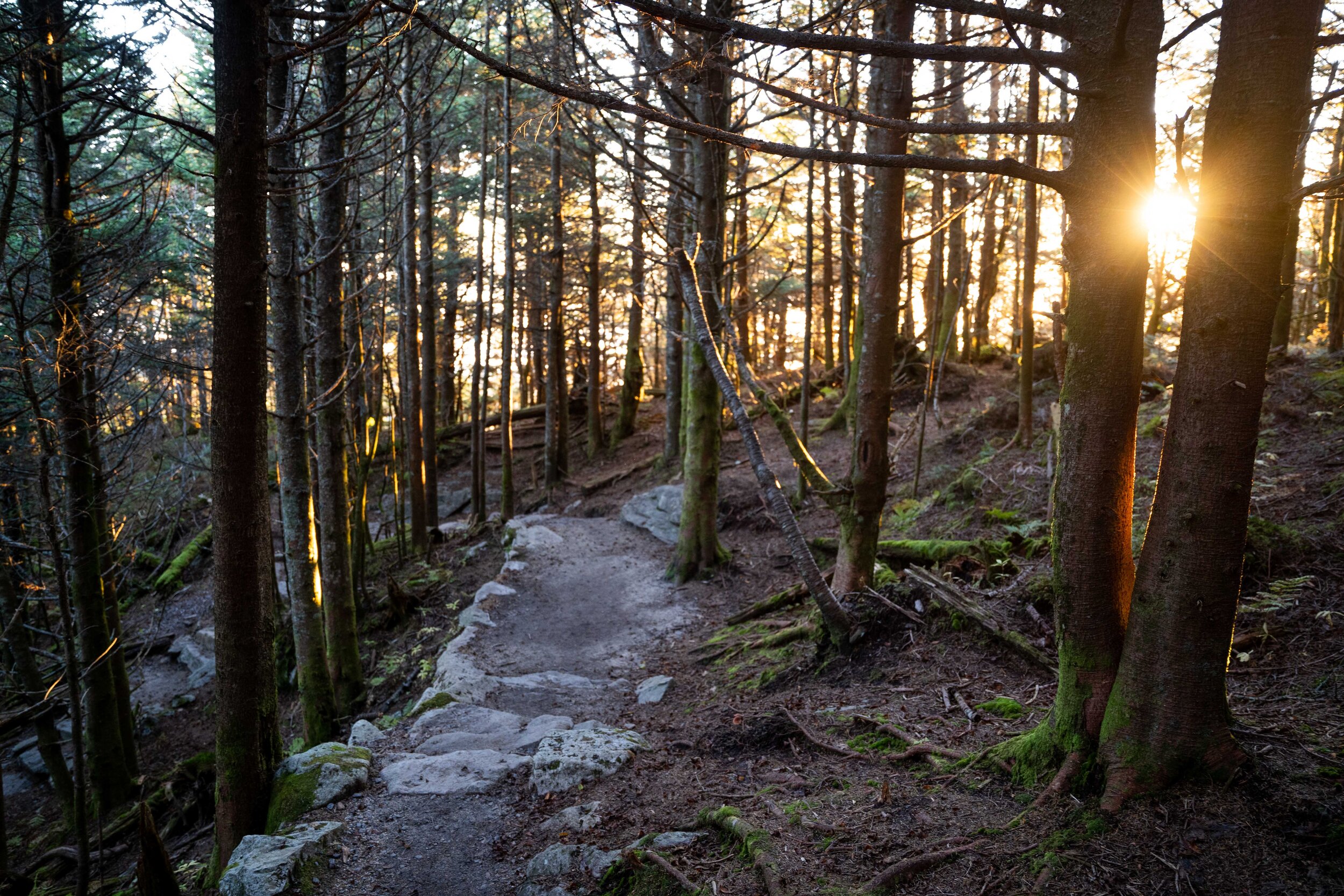
The Mountains to Sea Trail at The Chimneys.
Before battle, Viking berserkers are believed to have consumed a psychedelic mushroom, Amanita muscaria, also known as fly agaric. They’re red with white spots, like the super mushroom power-up in Super Mario Brothers - but with more and smaller spots.

Johnny and V.V. Kelly
“Amanita is growing here, it's a little late now for it — I saw some this year. My ex-husband and I used to hunt for it but I wouldn't ever take it. Not me,” says VV Kelly on Monday evening. Standing at the Glassmine Falls Overlook along the Blue Ridge Parkway in North Carolina, she’s with her current husband, Johnny Kelly. They’re from Asheville.
Ultimate Guide to Fall Foliage on the Blue Ridge Parkway in Western North Carolina
Elisha Mitchell (1793-1857), a scientist and professor died attempting to prove that the mountain now known as Mt. Mitchell was the tallest peak in the eastern United States. At 6,687 feet above sea level it is the highest point east of the Mississippi. Thomas David (Big Tom) Wilson (1825-1909), a famous guide and bear hunter of the Black Mountains, found Elisha’s body in July of 1857. You can make a short northern hike from the Mt. Mitchell pinnacle to the Big Tom peak at 6,559 feet.
“We are going to celebrate our 25th wedding anniversary in Viking style, with a Viking ship. But none are available in the Blue Ridge so we're gonna catch the scenes here and then make our trip up to Illinois where there is a Viking ship in dry dock,” says Johnny.
The couple is waiting on a photographer to commemorate their milestone together. “We're going to renew our vows. Twenty five years is something to celebrate,” says V.V.

Curtis Valley Overlook at 4460 feet, at mile post 349 on the Blue Ridge Parkway.
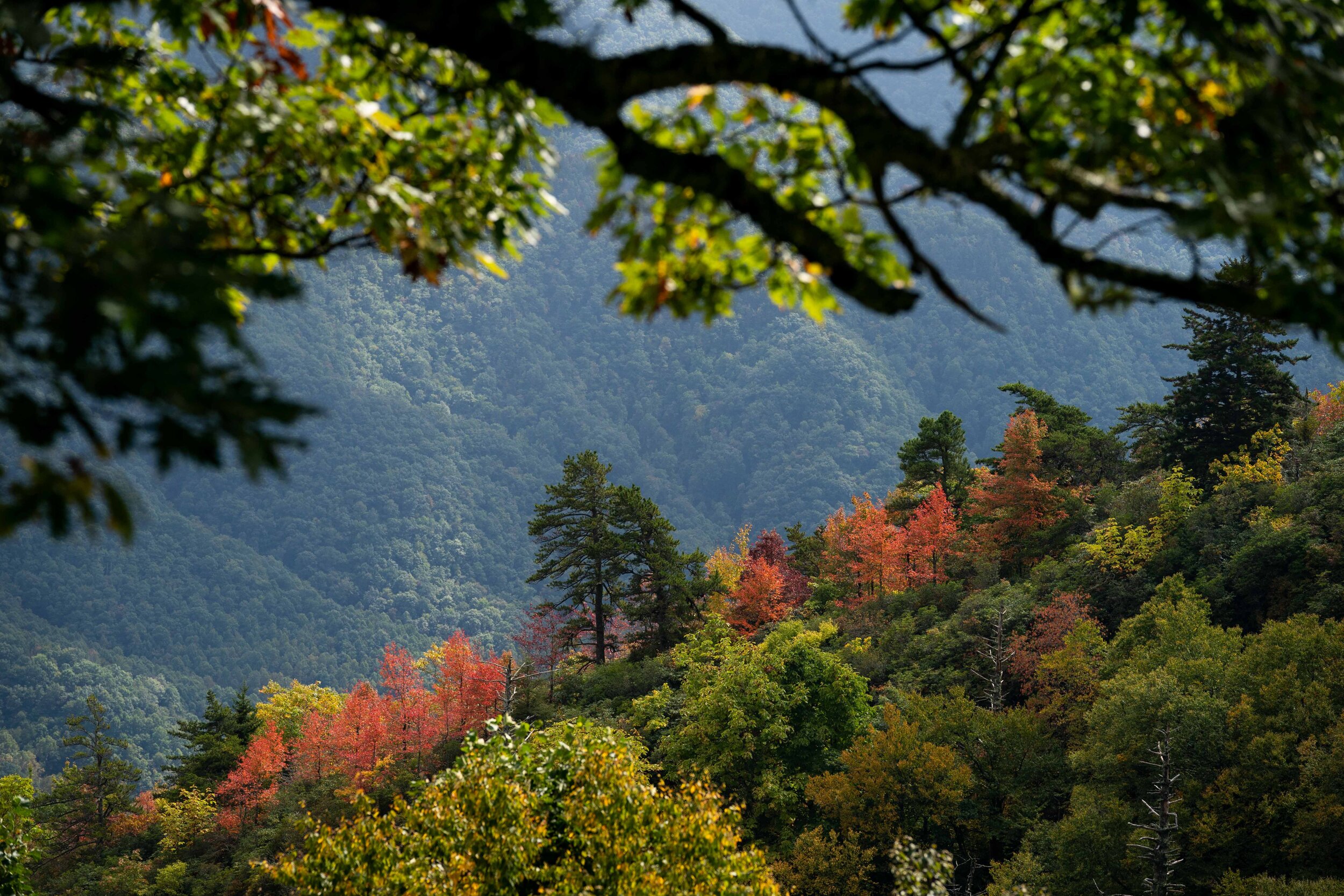
Behind the couple and sometimes partially obscured by a mountain mist, the leaves have begun to change colors. It’s mostly green, but there are spots of yellow, orange and red — most notably around the falls.
For those still hoping to catch the autumn display along the Blue Ridge Parkway and nearby areas, there’s plenty of good news. One can find a varied assortment color on the drive from Asheville to Boone as the elevation climbs from about 2,000 to 6,000 feet near Mt. Mitchell and back down to about 3,000 near Boone. Some sections are mostly green while a few spots may have peaked over the weekend.

The construction of the Blue Ridge Parkway began in 1935 with the final section, the Linville Viaduct (here) completed in 1987.. “The idea is to fit the Parkway into the mountains as if nature has put it there.” -Stanley Abbott, Chief Landscape Architect for the Parkway

Table Rock Mountain, left, at 3931 feet, from The Chimneys at 3521 feet.
Along the Linville Viaduct, at milepost 304 on the Blue Ridge Parkway. This section of the parkway hugs Grandfather Mountain and was built at a cost of $10 million.

The Deep Gap Trail can be accessed from the Mt. Micthell picnic area and stretches about 5.5 miles over the crest of the Black Mountains. Dominated by spruce and balsam fir trees, the trail takes one across multiple peaks above 6,000 feet.
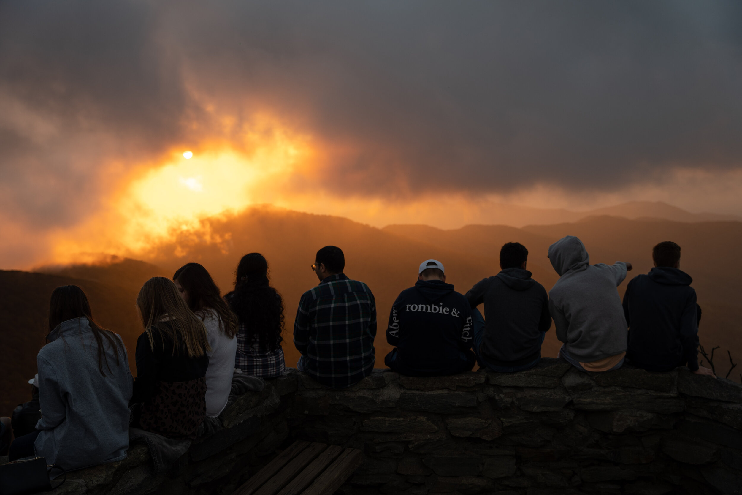
Revelers wait for sunset atop Craggy Gardens at milepost 367 on the Blue Ridge Parkway. The gardens are most popular for their floral displays in the spring months.
For more information about fall foliage in western North Carolina check out my Blue Ridge Parkway Fall Foliage Report Hub
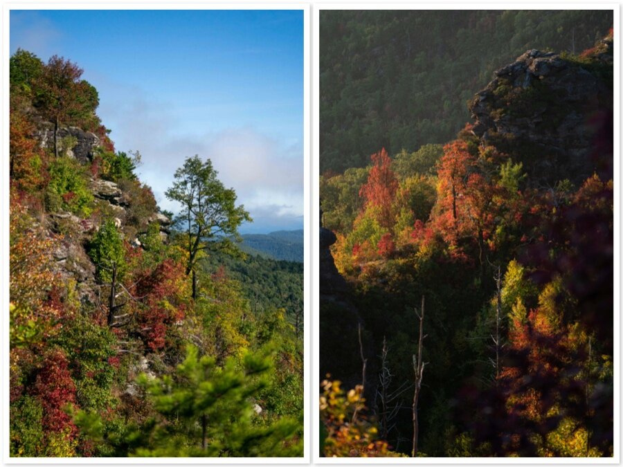
With many exposed rock formations The Chimneys are a popular spot for climbers and geologists.

The National Park Service reported that 14.1 million visitors traveled the Blue Ridge Parkway in 2020 spending $1.1 billion in nearby communities. “The Blue Ridge Parkway was built in part to support the economic vitality of the region it passes through in North Carolina and Virginia. The annual visitor spending report reminds us all of the important partnership between the park and local communities along the route to provide quality visitor experiences both on and off the Parkway,” says Blue Ridge Parkway Superintendent Tracy Swartout.


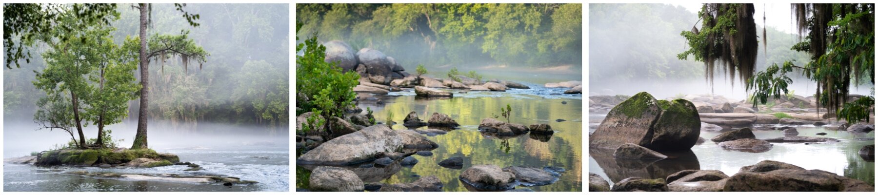
Linville Gorge

Mt. Mitchell pinnacle at sunrise. The University of North Carolina’s “Documenting the South” website states that Elisha Mitchell was caught in a thunderstorm, and apparently fell down a waterfall and drowned in the pool below.” His body rests in a grave at the peak.

The Chimneys overlook the Linville Gorge and Linville River 2,000 feet in the valley below.

There are more than 200 overlooks and parking areas along the 469 miles Blue Ridge Ridge parkway, which stretches through 29 counties in North Carolina and Virginia. It connects the Shenandoah National Park with the Great Smoky Mountains National Park.

Linville Gorge Wilderness

At the base of the Glassmine waterfall is an old mica mine, one of many mines operated in Western North Carolina during the early 1900s.

Some folks refer to the Linville Gorge as the "Grand Canyon of Eastern USA." It’s part of the Pigsah National Forest and is a federally-designated Wilderness Area.

The trailhead to The Chimneys trail can be reached via Gingercake Rd on a 7 mile bumpy gravel stretch that takes about 30-45 minutes to drive. There are many exposed and dangerous cliffs and the area is closed during the winter months.

Fog gathers along the Linville River. The river bisects the Linville Gorge with Jonas Ridge to the east and Linville Mountain on the west. Rock formations located on Jonas Ridge include Sitting Bear, Hawksbill, Table Rock, and the Chimneys.
To learn more about photographer Sean Rayford, visit SeanRayford.com